Welcome to My Page
About me
Hi, my name is Yoga Triardhana also known as zectre in internet. I am passionate about geospatial data processing and really excited with the development of geospatial data processing especially in Deep Learning. I was graduated with my bachelor major in Geodetic Engineering and now I am still learning something new everyday.
What is this page about?
This page is mainly discuss about anything geospatial related stuffs from geospatial databases, geospatial data processing (raster and vector), and many more. Check my pages on link below for more post about geospatial data processing.
Geospatial Python
This page contains anything related about geospatial data processing with python. More posts are in progress. You can visit this link to read more posts.

You can read about geospatial tools on python for geospatial data processing for both raster and vector data like geopandas, rasterio, earthpy, etc.
Geospatial Database
Managing geospatial data is like managing big data, it needs data science knowledge with a good database management system. I write stuffs about managing geospatial data with database management system like PostgreSQL with its well known geospatial extension PostGIS also with PGRouting for geospatial routing functionality. You can visit this link to see more posts about it.
Road Damage Identification using YOLO
In this research I was using YOLO with road damage dataset from IEEE road damage dataset (see more at https://github.com/sekilab/RoadDamageDetector)
I was using GNSS receiver for location data that will be used to determine the road damage location. I converted the location data into subtitle embeded on video. You can read more at https://github.com/zectre/yolo_rdd
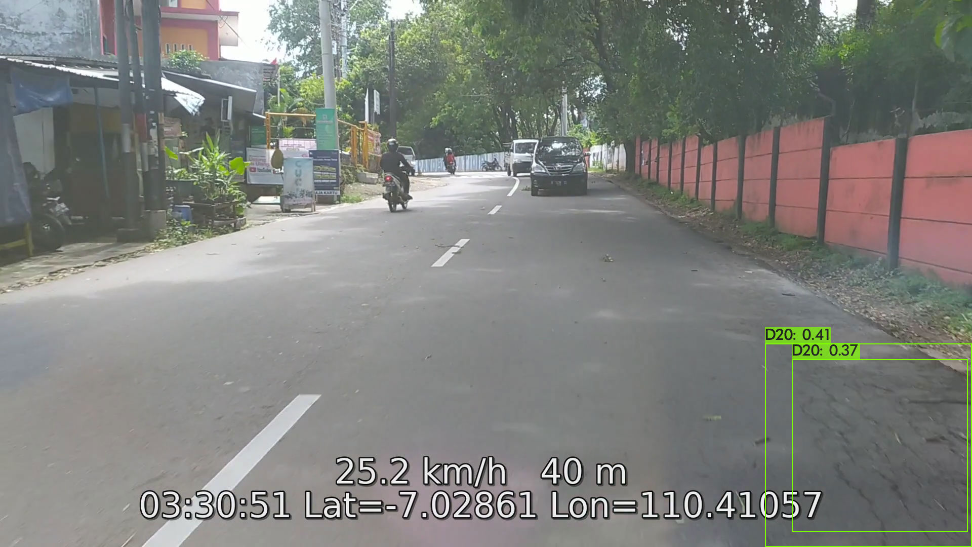 The output will be an image of detected road damage with its location. You can see the road damage location detected with this map
Sentinel 1 to 2 CycleGAN
 GAN is an interesting deep learning method for generating image including satellite imagery. I have tried using CycleGAN with using Sentinel 1-2 dataset. By using this you can generate rgb image like sentinel 2 imagery from sentinel 1 SAR data. I think this is a good adventage for area near equator that almost under clouds everyday. You can get rgb images from cloud penetrating imagery like sentinel 1 data. more result
Landsat 8 to High Resolution Imagery CycleGAN

GAN can be used for generating imagery including generating higher resolution of imagery. There are a lot of methods for generating higher resolution image like SRGAN for super resolution GAN but I was trying using CycleGAN for this topic. the result is not that good maybe because I am only using small dataset from Landsat 8-Sentinel 2 data I created. more result